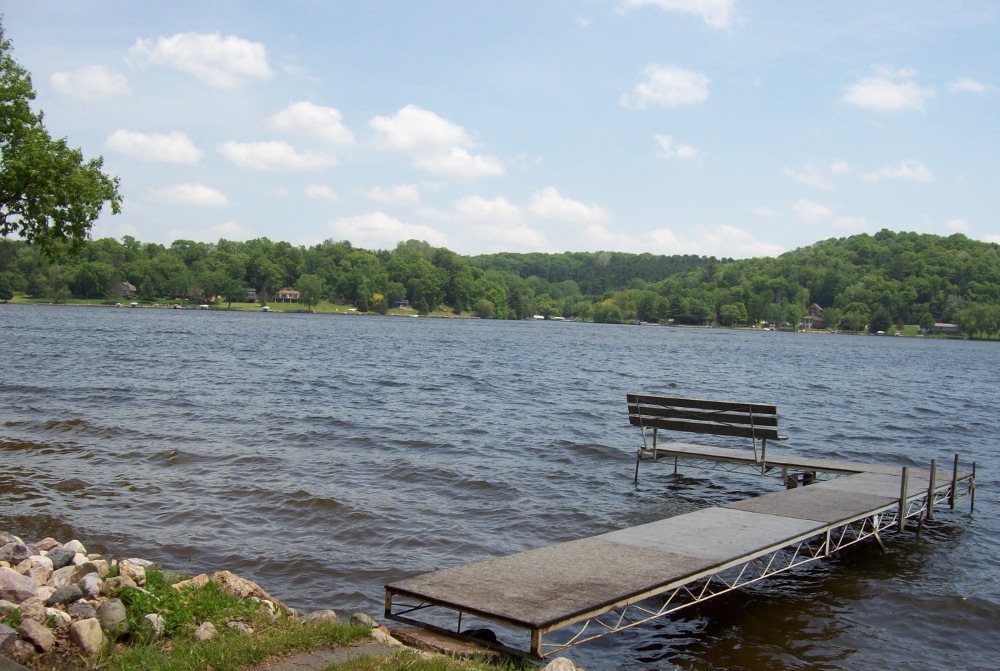
It is the Lake Wisconsin Alliance’s mission to educate our membership and local citizens about Lake Wisconsin and its surrounding watershed. LWA strives to not only provide general information about Lake Wisconsin, but also inform residents and visitors of the challenges facing the lake including urban and agricultural runoff, blue green algae, and shoreland erosion . Some of those challenges can easily be addressed through the implementation of best management practices such as rain gardens, erosion control practices, and shoreland buffers. Below are some of the resources LWA have found useful in educating residents about and providing solutions to these issues. In addition, LWA hosts bimonthly education meetings around the lake in order to provide information on relevant topics including “Blue Green Algae”, “Pier Regulations”, and “Shoreland Zoning”. Click here to see previous topics and presentation materials and check out our calendars to see upcoming meeting dates and topics.
Table of Contents
- Getting to know Lake Wisconsin & It’s Watershed
- Shoreland Zoning
- Shoreland Restoration & Erosion Control
- Rain Gardens
- Lakeshore Ownership Publications
- Blue Green Algae
- Pier, Dock & Wharves Regulations
- Storm Water Runoff
- Aquatic Invasive Species
- Plants and Animal Species of Lake Wisconsin
- Water Quality & Lake Monitoring
- Public Lands and Access Information
- Wisconsin River TMDL
- Volunteer Opportunities
Getting to know Lake Wisconsin & It’s Watershed
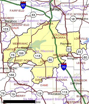
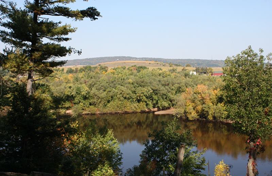
The Prairie du Sac Hydro Dam is located about one mile north of Prairie du Sac and is responsible for the formation of Lake Wisconsin. The construction of the dam began in 1911 and was completed in 1914 and has a capacity of about 31 megawatts. It is the last dam on the Wisconsin River before it enters the Mississippi River in Prairie du Chien. The watershed is approximately 215 square miles in size and covers portions of Sauk, Columbia, and Dane Counties.
Lake Wisconsin Watershed Information
Wisconsin Department of Transportation Merrimac Ferry Website
Wisconsin Historical Marker 187
Village of Merrimac – Ferry Information
Image source: http://dnr.wi.gov/water/watershedDetail.aspx?key=924917
Shoreland zoning has the goal of protecting water quality, fish and wildlife habitat, recreation and natural beauty. To accomplish these goals, the statewide minimum standards for shoreland zoning ordinances attempt to control the intensity and impacts of development around water and to maintain or establish a buffer between development and the waterway. Local planning and zoning department staff are available to assist landowners who have shoreland zoning questions.
Image Source: http://countrytimegazette.com/welcome/lake-redstone-wisconsin/
Local Contacts:
Sauk County Conservation, Planning & Zoning Department
505 Broadway
Baraboo, WI 53913
608-355-3245
Columbia County Planning and Zoning Department
400 DeWitt St
Portage, WI 53901
608-742-9660
Resources & Publications:
The Wisconsin Legislature has made major changes to shoreland zoning in 2015-16. These changes are described in three short video presentations:
- Introduction to shoreland zoning and recent changes to required shoreland lot sizes
- Changes to shoreland setbacks, vegetation protection and impervious surface standards
- Changes to standards for buildings located close to the shoreline
Wisconsin Shoreland Zoning Over the Years
Wisconsin’s Shoreland Management Program
Chapter NR 115: Wisconsin’s Shoreland Protection Program
Chapter 5: Columbia County Shoreland Wetland Protection Ordinance
Chapter 8: Sauk County Shoreland Protection Ordinance
Shoreland Restoration & Erosion Control
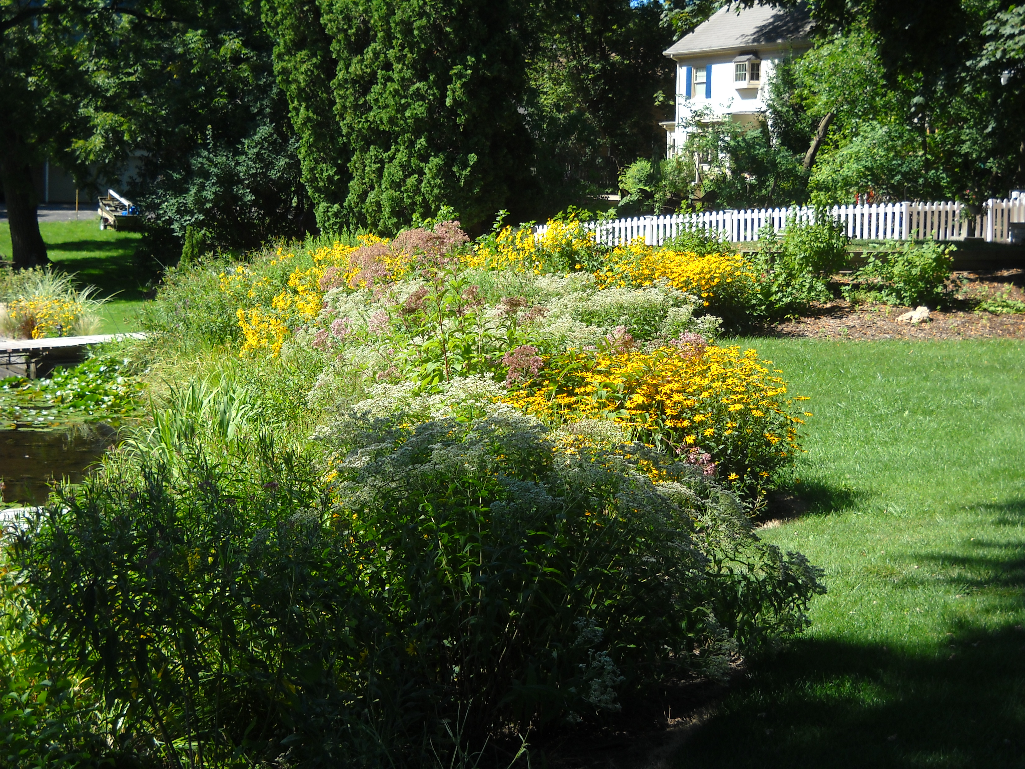 Natural shoreline features provide erosion control in various ways. Every shoreline is exposed to different natural events and human activities that can cause erosion. A small amount of soil erosion may not be a cause for any concern, but intervention may be needed on some shorelines. A permit may be required. Local land conservation department staff can provide technical assistance to landowners looking to restore their shoreland and prevent further erosion.
Image Source: http://www.llbmd.org/gallery/
Local Contacts:
Sauk County Conservation, Planning & Zoning Department
505 Broadway
Baraboo, WI 53913
608-355-3245
Columbia County Land & Water Conservation Department
120 West Conant St
Portage, WI 53901
608-742-9670
Resources & Publications:
Wisconsin DNR Lake Shore Erosion Website
Wisconsin DNR Waterway and wetland permits: shoreline Website
Wisconsin Natural Resources Magazine: A delicate balance where land meets water
Many of the publications listed below are available at your local UW Extension Office or Land Conservation Department. They are also available at the UW Extension Learning Store for purchase.
A Fresh Look at Shoreland Restoration
A green lawn running down to the water’s edge allows 18 times more sediment and seven times more phosphorus to run into the water than a natural shore allows. A natural shore also hosts a multitude of wildlife, much of it tiny, all of it important to the health of the environment. The authors suggest ways for owners of lake property to create a natural shore buffer of native vegetation between land and water, a buffer which will display “a seasonal array of colors, textures, aromas, and wildlife activity.
Protecting and Restoring Shorelands
The authors describe how to begin restoring a shore to its native state, a task that requires taking into account the topography and soil of the site, the width of the shoreline band that must be restored in order to accomplish various goals, and what native plants are best used for restoration. A shore with native vegetation can provide wildlife habitat, flood control, shoreline stability, privacy, and a pleasing variety of objects to amuse the eye. It also can improve water quality as it filters sediment, nutrients, pesticides, and microbes from surface runoff.
The authors sketch the intricate interconnection between plants, animals, and water along Wisconsin shores. They discuss the grasses, flowers, and trees that can be planted to restore a shore to its native state, and they suggest ways to minimize the crushing effects of man on a multitude of nature’s creatures, including salamanders, muskrats, mayflies, frogs, turtles, bass, and bats.
Protecting Your Waterfront Investment: 10 Simple Shoreland Stewardship Practices
Healthy watersheds make healthy lakes and higher property values. Created for people who live on developed waterfront lots, this publication describes three major ways to protect your property investment.
The Water’s Edge: Helping Fish and Wildlife on Your Waterfront Property
This introduction to life at The Water’s Edge reveals the advantages of a natural, wildlife-friendly shore, and describes how you can restore, create, or maintain a natural shore without needing to give up your lawn and dock. In short, you can have your lawn, your dock, and wildlife too.
A Second Life for Trees in Lakes: As Useful in Water as They Were on Land
Woody debris in the water food, shelter, and breeding areas for many wildlife species including aquatic insects, frogs, turtles and a variety of fish species. This publication provides information on the benefits associated with leaving woody debris in lakes.
The Economics of Shoreland Protection
A growing body of research shows that waterfront property owners, local governments, economies and taxpayers benefit economically as a result of the amenities shoreland zoning preserves: clean water, wildlife, scenic beauty, and peace and quiet. Surveys of Wisconsin lakefront property owners and visitors consistently rate these as the amenities that attract them to the water. This publication summarizes these public and private benefits.
Wisconsin’s Healthy Lakes Program
 Wisconsin’s Healthy Lakes Implementation Plan goal is to protect and improve the health of our lakes by increasing lakeshore property owner participation in habitat restoration and runoff and erosion control projects. The following frequently asked questions about funding and administering a Healthy Lakes project may help you get the answers you’re looking for.
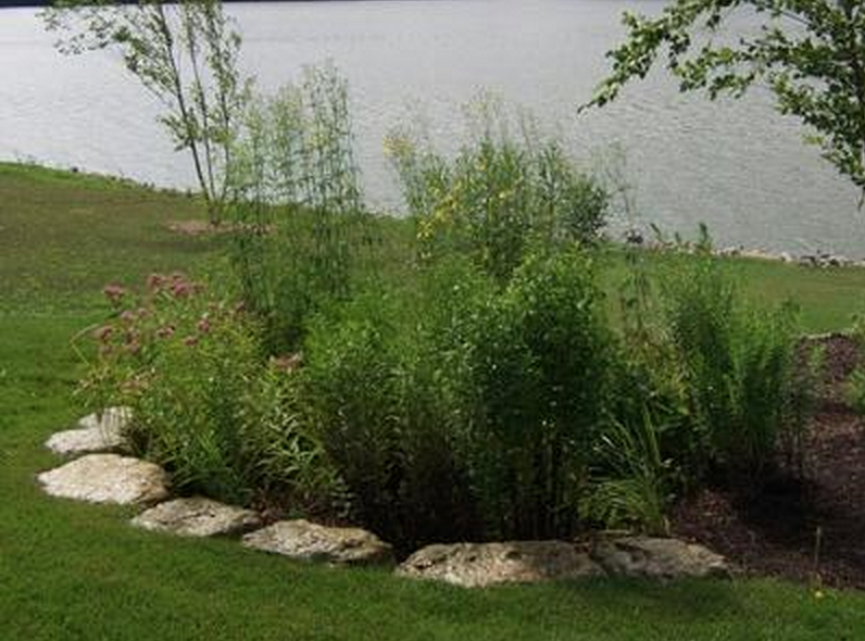 Rain gardens, small, shallow areas filled with beautiful native plants, reduce polluted runoff from entering Wisconsin’s waters. Creating a rain garden is a great way for homeowners, schools, businesses, churches, and other organizations to help protect our lakes and streams. Rain garden plants capture 30% more water than a regular lawn and filter that water into the ground. This reduces the amount of water containing household fertilizers, pesticides, oils, and other contaminants coming from our roofs, lawns, driveways, or parking lots running into storm sewers. Rain gardens are also a delight to view and are a nice place for birds and butterflies to live.
Image Source: http://www.kittlesonlandscape.com/stone-landscaping/landscape-water-features
Multiple Publications related to rain gardens can be found at the UW-Extension Lakes Page
Lakeshore Ownership Publications
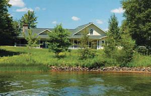 Many things must be considered when buying waterfront property, including lake or river quality, shore quality, regulations for using the lake or river, local amenities, what the surrounding area offers, neighbors, costs, how the body of water looks at various times of year, and much more. Below are publications that will prepare new waterfront property owner for life on the water and guide potential buyers of waterfront property make the right choice.
Image Source: http://dnr.wi.gov/wnrmag/2010/04/waterfront.htm
Resources & Publications:
Choosing the Right Waterfront Property
Many things must be considered when buying waterfront property, including lake or river quality, shore quality, regulations for using the lake or river, local amenities, what the surrounding area offers, neighbors, costs, how the body of water looks at various times of year, and much more. All this is discussed in detail in order to help buyers of waterfront property make the right choice.
Life on The Edge: Owning Waterfront Property
This practical and easily understood publication provides an overview on a host of topics such as selecting a place, living with wildlife, wells and septic systems, zoning near water, your rights near the water, saving your shore, piers and docks and plant control. At the end of each chapter you will find references for further reading.
The Value of Good Water Quality and Shoreland Management
 Blue-green algae, also known as Cyanobacteria, are a group of photosynthetic bacteria that many people refer to as “pond scum.” When environmental conditions are just right, blue-green algae can grow very quickly in number. “Blue-green algae blooms” can be dangerous to humans and animals. Below are publications to help you identify blue green algae and the health impacts related to exposure.
Image Source: http://dnr.wi.gov/wnrmag/2009/08/images/creature.jpg
Local Contacts:
Sauk County Health Department
505 Broadway
Baraboo, WI 53913
608-355-3290
Columbia County Department of Health & Human Services
2652 Murphy Rd
Portage, WI 53901
608-742-9227
Resources & Publications:
Wisconsin DNR Blue-Green Algae Website
Exposure to Blue Green Algae on the Skin
Wisconsin DHS Blue-Green Algae Website
Harmful Algal Blooms in Wisconsin’s Lakes
Keeping Your Pet Safe from Harmful Algal Blooms
Pier, Dock & Wharves Regulations
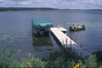 Piers are a popular focus for boating and waterfront recreation. What pier owners need to know is that they can continue to place their existing piers on the water, the same as they’ve been doing for years. Most existing piers and wharves are grandfathered. All existing piers and wharves that were first placed in the water before April 17, 2012 are exempt from needing state approval and can be placed in lakes and rivers the same as they always have with few limitations.
Image Source: http://dnr.wi.gov/topic/waterways/images/exemptpier200x134.jpg
Resources & Publications:
Wisconsin DNR Pier Regulations Website
Chapter NR 326: Piers, Boat Shelters and Swim Rafts in Navigable Waters
Chapter 30: Navigable Waters, Harbors, and Navigation
Comprehensive study looks at pier impacts on fish and aquatic life
Pier Frequently Asked Questions
Maps/Lake Access
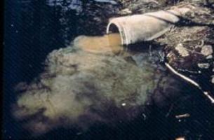 Storm water runoff is rain and melting snow that flows off building rooftops, driveways, lawns, streets, parking lots, construction sites, and industrial storage yards. Developed areas are covered by buildings and pavement which do not allow water to soak into the ground. Much of this water goes untreated and enters our lakes and rivers.
Image Source: http://dnr.wi.gov/topic/stormwater/learn_more/whatis.html
Resources & Publications:
Wisconsin DNR Storm Water Runoff Website
Improper disposal of pet waste affects water quality and human health. This publication offers alternatives.
Protect our Lakes & Streams: Help Stop Polluted Water Runoff
This fact sheet looks at taking simple steps to clean up our lakes and streams, serious problems caused by sediments and nutrients, and offers suggestions on what can be done to help improve water quality in regards to polluted runoff
Impervious Surfaces: How they impact fish, wildlife and waterfront property values
When waterside residences are built, inevitably a quantity of land along the shore is covered by various surfaces impervious to water—roofs, driveways, roads, walkways, patios, and so forth. Rainfall no longer soaks into an almost entirely permeable landscape of dirt, sand, sedgy shores, and grassy banks, but instead much of it rushes unfiltered straight into the stream or lake, carrying with it sediment, nutrients, bacteria, car fluids, and other chemicals that pollute. The unhappy result is murkier water, fewer fish, declining wildlife populations, and lower property values.
Polluted Urban Runoff: A Source of Concern
This is a summary of the pollutants that originate in urban landscapes and run off into Wisconsin’s rivers and lakes. Pollutants include pesticides, various other chemicals, metals, and bacteria. Pie charts show the proportion of total pollution that originates on roofs, streets, parking lots, and so on.
Controlling Runoff and Erosion from Your Waterfront Property: A Guide for Landowners
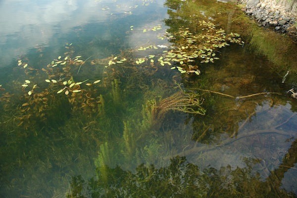 Whether they come in ballast water, on the hulls of recreation boats or from the water of an angler’s bait bucket, many non-native species such as zebra mussels and Eurasian water milfoil have found their way into Wisconsin’s waterways. Their presence can cause severe damage to local ecosystems, industry and tourism.
Image Source: http://news.wisc.edu/22243
Resources & Publications:
Chapter NR 40: Invasive Species Identification, Classification and Control
Wisconsin DNR Aquatic Invasive Species Website
University of Wisconsin Sea Grant Institute Aquatic Invasive Species Website
River Alliance Aquatic Invasive Species of Concern Website
Aquatic Invasive Species: A guide for Proactive & Reactive Management
Plants and Animal Species of Lake Wisconsin
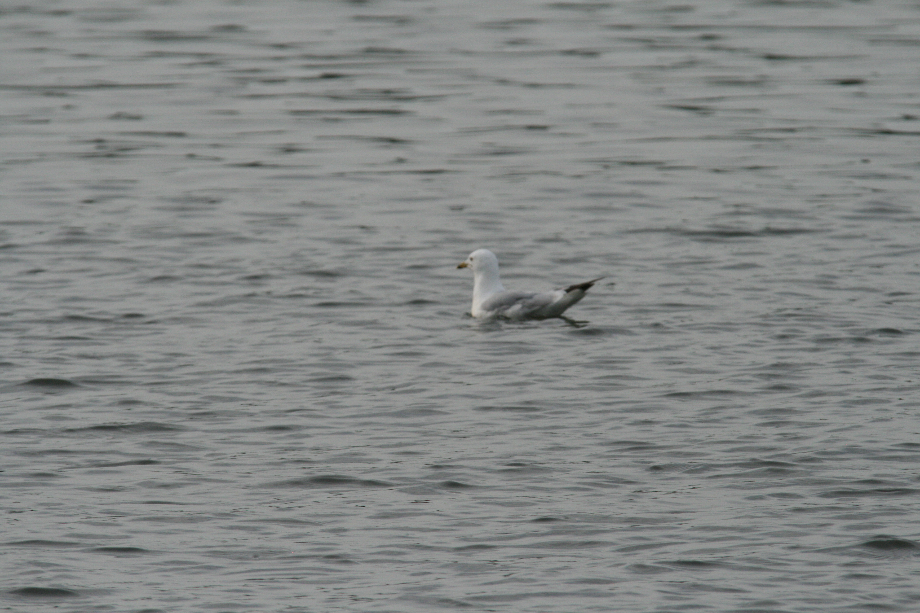
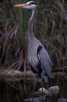 Lake Wisconsin is home to many plants, fish, and wildlife species. Below are publications to assist residents and visitors of Lake Wisconsin with identifying these species.
Image Source: http://dnr.wi.gov/topic/EndangeredResources/Animals.asp?mode=detail&SpecCode=ABNGA04010
Comprehensive Fisheries Survey of Lake Wisconsin (2012)
Through the Looking Glass…A Field Guide to Aquatic Plants
This delightful, large-format field guide to aquatic plants in North America is accessible and inviting to general readers, yet detailed enough for use by botanists and natural resource managers. Covering freshwater plants and some found in brackish waters, the book is organized into sections on emergent plants, free-floating plants, floating-leaf plants, and submersed plants. Charming habitat drawings introduce each section. The fine pen and ink drawings for each species showing the entire plant are supplemented, where helpful, with detailed drawings of leaves, stem cross-sections, seeds, flowers, and other distinguishing features. Nature lovers, waterfront property owners, teachers and students, and water resource specialists will enjoy this closer look at aquatic plants, from the familiar cattail and wild rice to the more obscure bladderworts and milfoils.
Water Quality & Lake Monitoring
 Water quality can refer to water clarity; or, how far light can penetrate down into the water. Clear water allows the sunlight to reach underwater aquatic plants that provide food and shelter for many aquatic wildlife species. Clear water also allows fish to see their prey and avoid being eaten by predators. Volunteers measure water clarity using a black and white disk called a “Secchi Disk”.
Resources & Publications:
Citizen Lake Monitoring Network
Wisconsin DNR Water Quality Website
Wisconsin Lakes Water Quality Website
Lake Wisconsin Lake Monitoring Reports
Lake Wisconsin Lake Levels
Public Lands and Access Information
Navigation Guide to Lake Wisconsin (PDF file)
View a Google Map with Access Areas on Lake Wisconsin
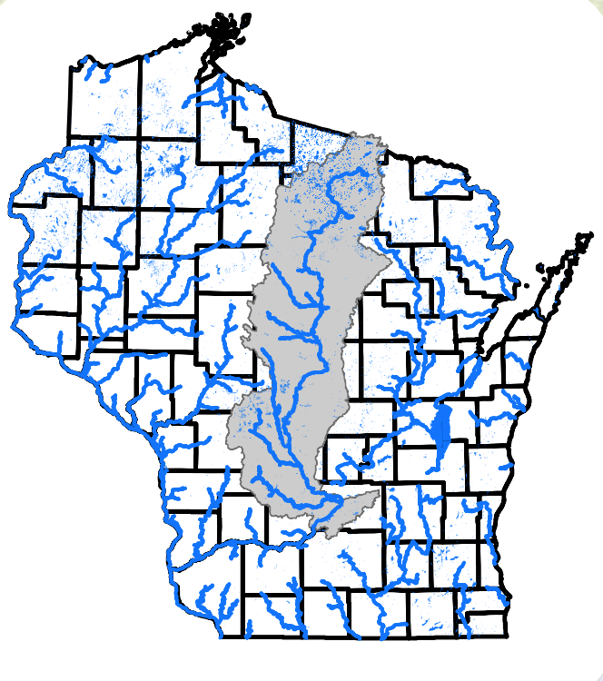 The DNR, together with many partners throughout the basin, are working to improve water quality of the Wisconsin River, its reservoirs and tributaries. The Total Maximum Daily Load (TMDL) study and implementation plan will provide a strategic framework and prioritize resources for water quality improvement in the Wisconsin River Basin.
The Wisconsin River TMDL study area spans Wisconsin’s central corridor from the headwaters in Vilas County to Lake Wisconsin in Columbia and Sauk County, covering 9,156 square miles, approximately 15 percent of the state.
Image Source: http://dnr.wi.gov/topic/TMDLs/documents/WisconsinRiver/WRB_Basemap_8.5_11.pdf
Other Organizations
Lake Tides: The FREE newsletter for people interested in Wisconsin Lakes
Friends of the Lower Wisconsin Riverway (FLOW)
Petenwell and Castle Rock Stewards
With the growing concern over the spread of aquatic invasive species to Wisconsin’s inland lakes, many lake association members and other concerned citizens are looking for ways to get involved. The Clean Boats, Clean Waters watercraft inspection program is an opportunity to take a front line defense against the spread of aquatic invasive species.
Through the Clean Boats, Clean Waters program, inspectors are trained to organize and conduct a boater education program in their community. Adults and youth teams educate boaters on how and where invasive species are most likely to hitch a ride into water bodies. Inspectors perform boat and trailer checks for invasive species, distribute informational brochures and collect and report any new water body infestations.
Citizen Lake Monitoring Network
The Citizen Lake Monitoring Network goal is to collect high quality data, to educate and empower volunteers, and to share this data and knowledge. Volunteers measure water clarity, using the Secchi Disk method, as an indicator of water quality. Volunteers may also collect chemistry, temperature, and dissolved oxygen data, as well as identify and map plants or watch for the first appearance of Eurasian Water Milfoil near boat landings.

